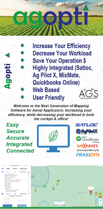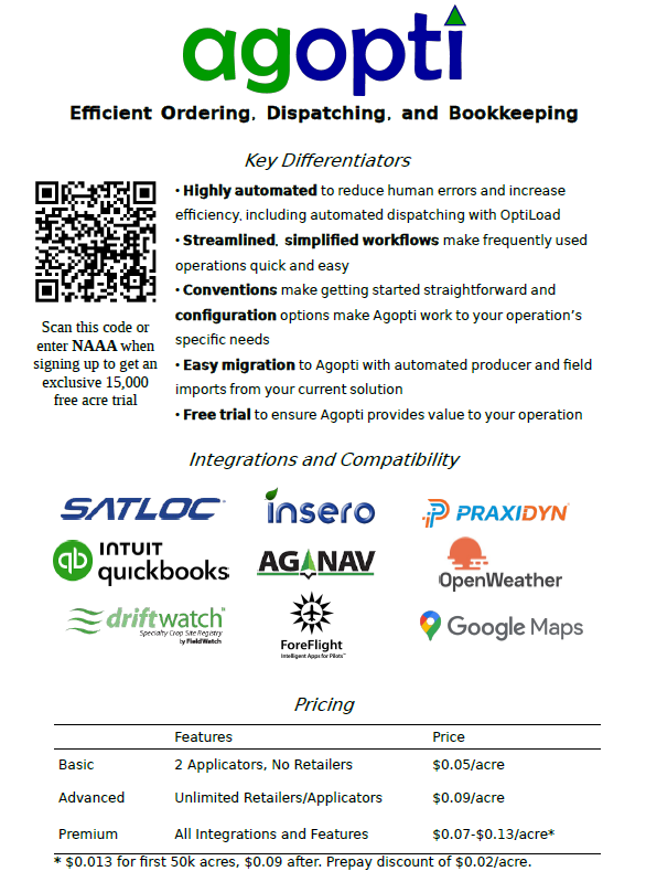
In aerial application, efficiency is everything. Aerial Guidance Solutions brings you AgOpti—powerful mapping software that simplifies your workflow from field to office. Built for real operations, it helps you save time, reduce errors, and stay connected.